Forecast Informed Reservoir Operations (FIRO)
FIRO is a flexible water management approach that uses data from watershed monitoring and improved weather forecasting to help water managers selectively retain or release water from reservoirs for increased resilience to droughts and floods. FIRO applies emerging science and technology to optimize water resources and adapt to climate change without costly infrastructure. The goal of FIRO at Lake Mendocino is to update the 1950s-era Water Control Manual by applying forecasting advancements to increase water supply reliability without reducing - and while possibly enhancing - the existing flood protection capacity of Lake Mendocino and downstream flows for fish habitat.
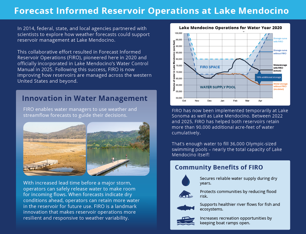

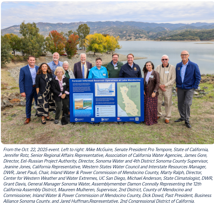
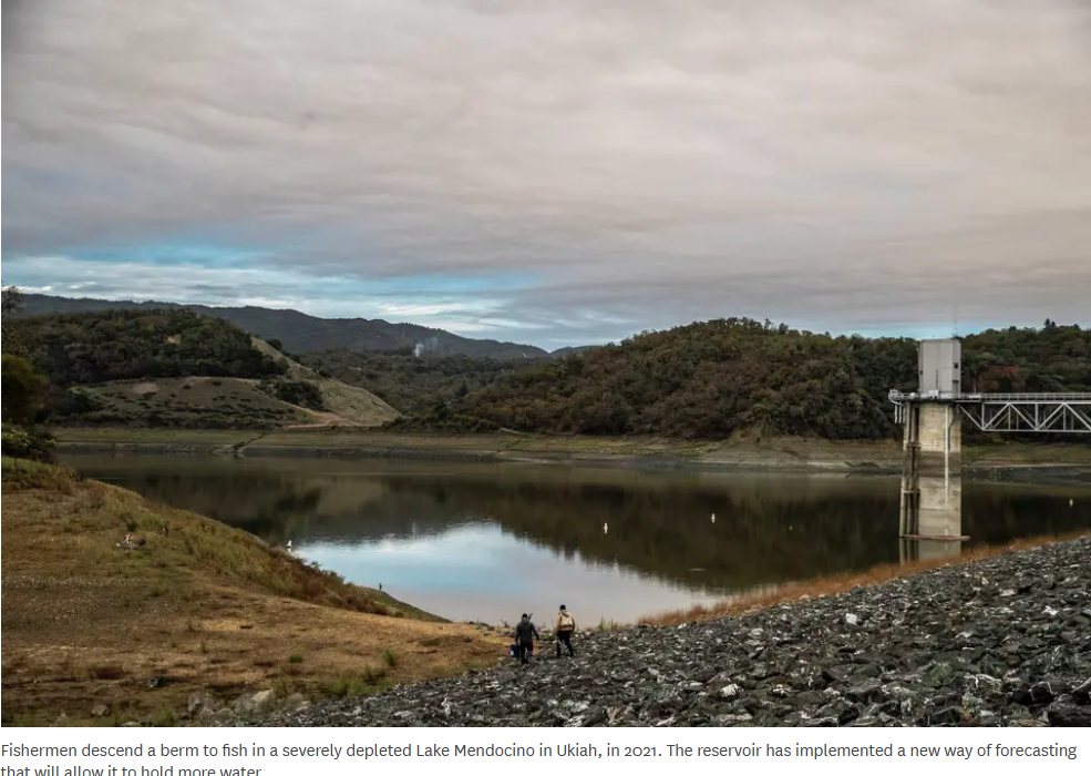
Representatives gathered on Wednesday, October 22nd to celebrate the signing of the water management strategy known as FIRO – the Forecast Informed Reservoir Operations. The Water Control Manual (WCM) update represents over a decade of collaborative work across multiple agencies. In addition to Sonoma Water and the Corps, this coordinated effort included the National Oceanic and Atmospheric Administration, Scripps Institute of Oceanography Center for Western Weather and Water Extremes, U.S. Bureau of Reclamation, California Department of Water Resource, local partners and the community. Lake Mendocino will be the first reservoir to have an updated WCM that implements FIRO. The efforts at Lake Mendocino have now led to the evaluation of FIRO at multiple reservoirs throughout the West.
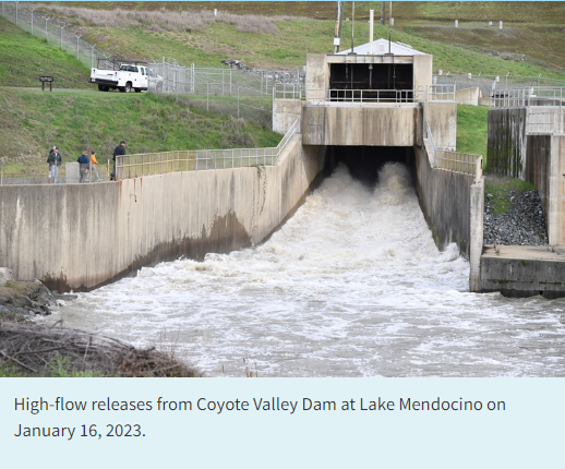
“Before this update, we would inevitably be required to release water to give airspace to the dam for the next storm regardless of the upcoming weather,” said Nick Malasavage, Operations & Readiness Division chief for the USACE San Francisco District. “FIRO allows us to be informed by the forecast and make better decisions.”
In accordance with the National Environmental Policy Act (NEPA) of 1969 (42 U.S.C. § 4321 et seq), as amended, the United States Army Corps of Engineers, San Francisco District (USACE) has prepared a Draft Environmental Assessment (EA) for the Coyote Valley Dam (CVD)-Lake Mendocino Water Control Manual (WCM) Update.
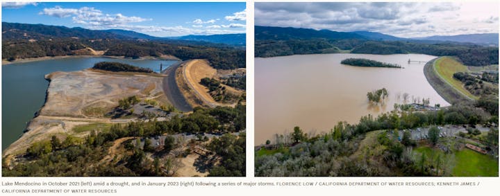
Current operations of the CVD-Lake Mendocino are governed by the existing WCM which was revised in 1986 and last updated in 2011 without the benefit of modern weather and streamflow forecasting information. The draft EA provides an evaluation and description of the proposed action to update the CVD-Lake Mendocino WCM to allow discretionary encroachment into Flood Control Space based on the 5-day deterministic streamflow forecasts provided by the National Weather Service as per Lake Mendocino Forecast-informed Reservoir Operations (FIRO) procedures that have been vetted and tried through a series of USACE-approved major deviations during Water Years 2019, 2020 and 2021-2026. The encroachment would provide water storage of up to 11,650 acre-feet into the flood control space, and USACE reservoir operators retain full operational control and authority.
The USACE is providing this notice of availability of the draft EA for public review and comment. The public comment period will run until August 16, 2025.
The Draft EA and associated appendices can be accessed by navigating a web browser to the website below and clicking on the “Draft Environmental Assessment” under the title called “Coyote Valley Dam-Lake Mendocino Water Control Manual Update” in the left-hand side of the page to open the report document. Website: https://www.spn.usace.army.mil/Missions/Environmental/
Visit the Department of Water Resources FIRO page: https://water.ca.gov/News/Blog/2023/Jan-23/Californias-Forecast-Informed-Reservoir-Operations-Are-Key-to-Managing-Floods-and-Water-Supplies
Visit the Center for Western Weather and Water Extremes FIRO page: https://cw3e.ucsd.edu/firo/
Visit Sonoma Water for more information on FIRO at Lake Menodcino: https://www.sonomawater.org/firo